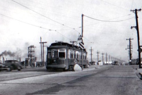
From 1896 through 1940, Chicago streetcars ran across the Indiana border into Whiting and Hammond. The top photo was taken shortly after the route was cut back to the state line. The smoke on the left of the picture might be coming from the nearby ComEd plant, or from one of the factories along the lake shore.
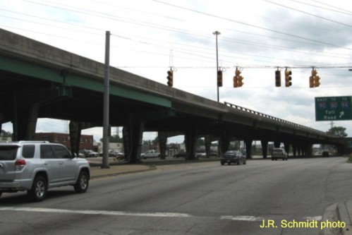
In 2014 the scene is dominated by the Chicago Skyway, here crossing the border to become the Indiana Toll Road. The area is still largely industrial. However, the local economy has now been diversified by a couple of casinos.
—30—


0 Responses to “Then and Now, Indianapolis-State Line”